Isla Saona
Isla Saona
El Parque Nacional del Este esta coronado en su área marítima por una de las islas más hermosas del Caribe: la isla Saona. La isla presenta una forma alargada con una longitud en su eje principal de 22 Km, y una anchura media de 5 a 6 Km.
La isla Saona tiene una topografía casi plana, a excepción de la costa noreste, donde existe un acantilado que alcanza aproximadamente 40 metros en la Punta Balaju. Las depresiones del terreno en la isla están ocupadas por lagunas de agua salada y terreno cenagoso. En la isla se localizan tres lagunas entre las que destaca la laguna de Los Flamencos. Sus principales playas se encuentran desde Punta Capuano, en el Noroeste, hasta Punta de Cruz, en el Sureste, exceptuando un sector en el extremo sur, que va desde Playa los Abanicos hasta Punta Laguna.
En las aguas adyacentes a la costa de toda la isla se encuentran importantes formaciones de arrecifes coralinos en una profundidad que varia de 1 a 60 metros. Estos arrecifes destacan por su potencia, resultando una de las formaciones naturales sumergidas más importantes de toda la Republica Dominicana.
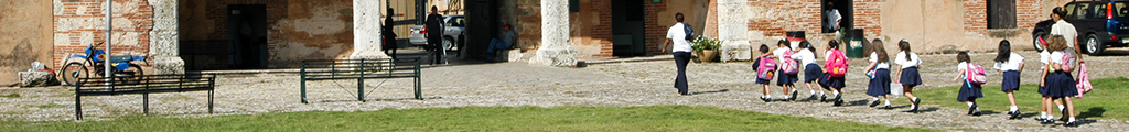
La isla Saona cuenta con un pequeño destacamento de la marina de guerra y una caseta de guarda parques situados en Catuano, y una comunidad establecida en el poblado de Mano Juan. Allí no viven más de 400 personas, quienes se dedican fundamentalmente a la pesca y a vender objetos de artesanía a los turistas que llegan al enclave. En el poblado existen alrededor de 80 casas, en su mayor parte de madera y de humildes características. La energía eléctrica se la suministra una planta que funciona durante algunas horas al día y el agua se recoge en cisternas procedente de las lluvias. También se aprovechan algunos pozos de agua salobre que se encuentran dentro de los limites del poblado.
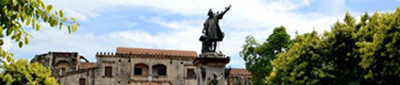
La primera vez que los europeos visitaron el futuro Parque Nacional del Este fue en 1.494, cuando Cristóbal Coóon volvía de su viaje de exploración por Cuba y Jamaica hacia su base en la Isabela, en la costa Norte de la isla. En aquel viaje, Colón le regaló la isla, que los tainos nombraban Adamanay, a su amigo y compañero de viaje Miguel de Cunneo, quien la rebautiza como Bella Savonese en recuerdo de su Savona natal, en Italia. De la corrupción de aquel nombre original deriva el actual nombre de la isla, Saona. Durante la visita, y debido a la llegada de un huracán, Colón se refugió durante siete u ocho días con su nave en el canal de Capuano, que separa la isla del área continental el Parque Nacional del Este. Allí observó y registró un eclipse de luna el 15 de Septiembre de 1.494.
Durante el siglo XVI y XVII la utilizaron como punto de observación para controlar el paso de barcos enemigos. Posiblemente fuera también utilizada como base por barcos piratas. En 1.630 aparece la primera constancia de una ocupación ilegal de la isla por extranjeros y la posterior quema de los bohíos y aprensión de los colonos, situación que vuelve a repetirse en 1.771. Al parecer, hasta mediados del siglo XIX, la Saona solamente fue poblada esporádicamente, limitándose su uso a la tala de árboles o como puesto de vigilancia marítima. En 1.855 la isla fue concedida al general Pedro Santana por un periodo de 50 años para que explotara sus ricos bosques de caoba, pero al año siguiente esta concesión fue anulada.
En tiempos del dictador Leonidas Trujillo esta isla fue adjudicada a su familia quienes explotaron los cocotales que se existían desde una fecha indeterminada. Fue este presidente quien en 1.944 construyo el poblado de Mano Juan para albergar a 14 familias que se asentaron. Este poblado fue utilizado también para desterrar a los disidentes políticos del régimen del dictador. En ese momento la isla era un coto de caza y una finca para la crianza extensiva de ganado. Básicamente se cazaba la paloma coronita (Columba leucocephala) que en la época de migración cubría literalmente los bosques de la isla. El 16 de Septiembre, se emitió el decreto que creó el parque del cual forma parte.
Enlaces rápidos
Conéctate con nosotros
Puede mantenerse al día con nuestras noticias, eventos y actividades a través de nuestros canales digitales usando:
![]()
![]()
![]()
Quiero mantenerme actualizado:
Manténte informado con los últimos eventos y publicaciones. Ingresa tu correo electrónico en este simple formulario y te estaremos enviando noticias y actualizaciones directamente a tu cuenta.
¡Registrarme ahora!